Navigating the four point perspective
The earth is spherical. On a traditional map, the curved surface of the earth is displayed on a flat plane. In order to do this one needs to flatten the globe. Compare it to ‘cutting’ open the earth from top to bottom and then stretching out the top and bottom.
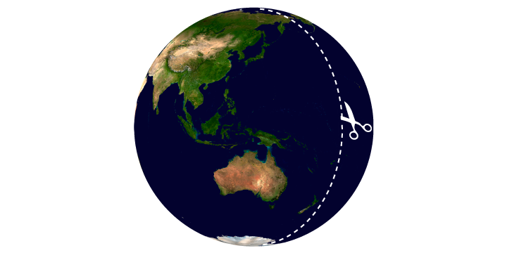
Cut, stretch and flatten globe
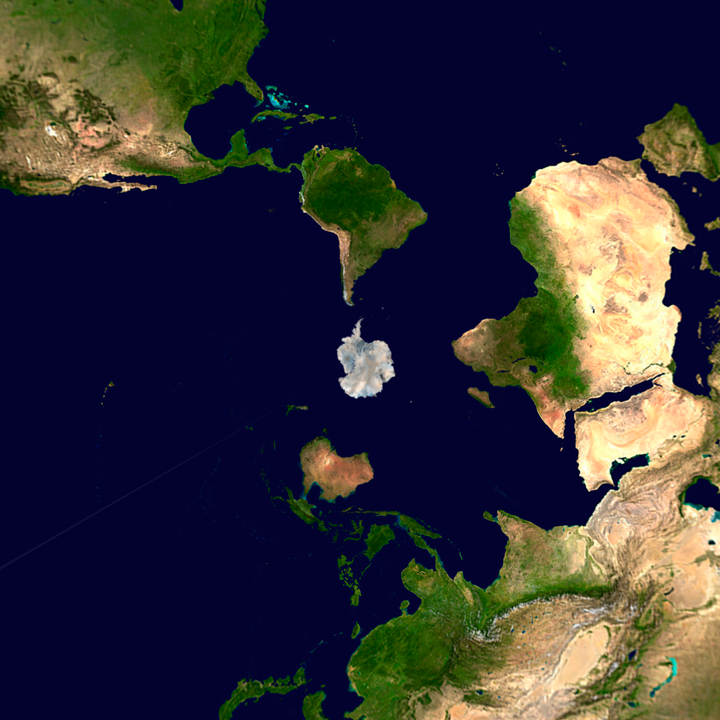
Equirectangular projection, the projection I most often use for my illustrated panoramas, is similar to the projection used for maps. The north and south poles are stretched to a line across the full width of the map. In reality they are a single point on the surface of the globe. This is why Antarctica and Greenland appear huge.
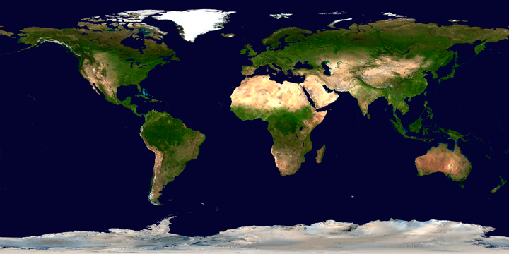
Map in equirectangular projection
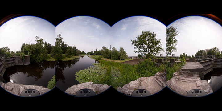
Four fish eye pictures
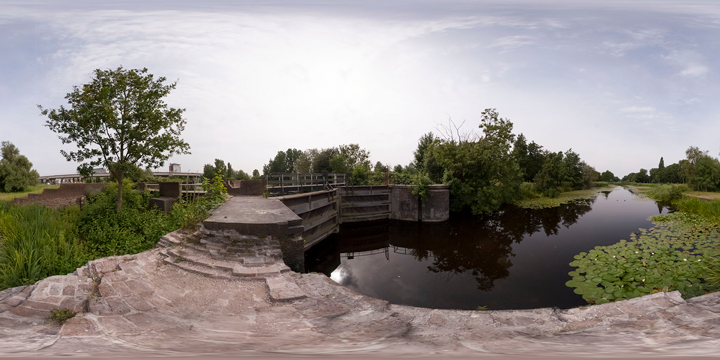
Photo in equirectangular projection
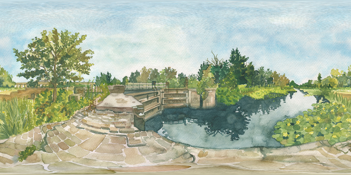
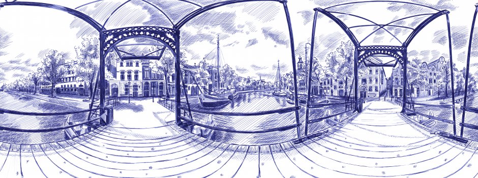
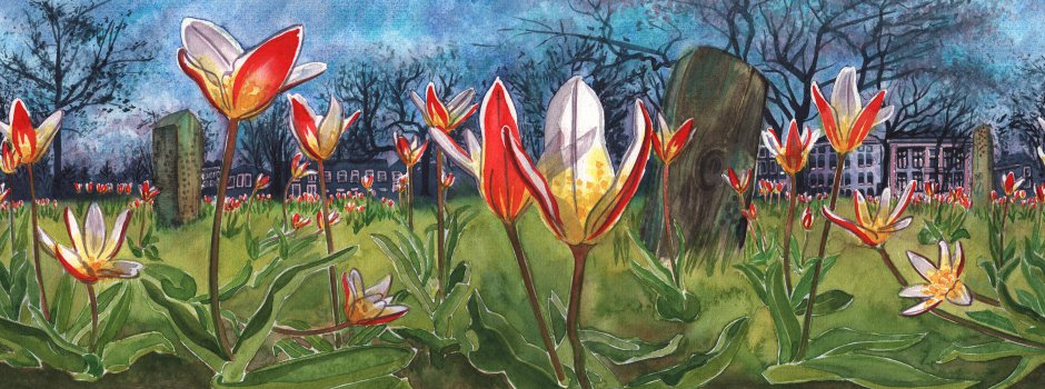
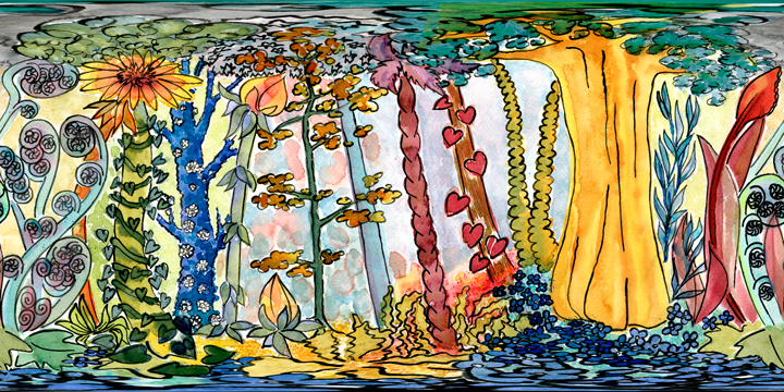
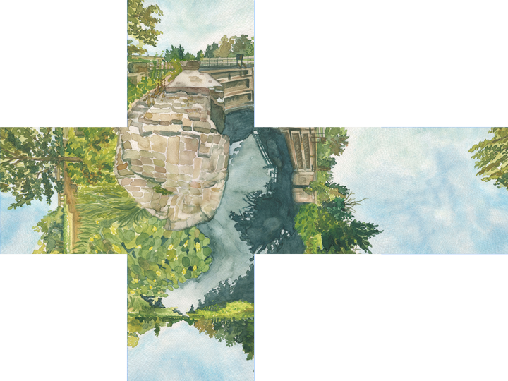
Drawing in equirectangular projection: Vijfsluizen in Watercolour
My drawings are often based on fisheye photos, ‘stitched’ together to form an 360x180 degree equirectangular image. Lately I've been using a Ricoh Theta S, an ‘instant’ panorama camera. No stitching needed.
The point in the ceiling or air directly above the camera (zenith) is just as the north pole stretched into a line. The same applies to the soil (nadir) and the South Pole.
The distortions, here mostly noticeable in the ground plane are a direct result of the 360x180 degrees perspective of the image.
Regular linear perspective rules don't apply in a panorama drawing. Instead of one vanishing point there are multiple. Whenever I draw a 'freehand' panorama I use a 'four point perspective grid' to figure things out.
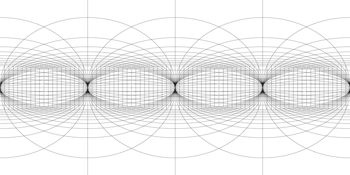
Four point perspective
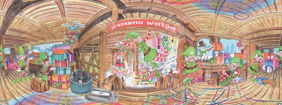
Freehand panorama: Perelin, der Nachtwald
From an equirectangular image, lots of other projections can be calculated. The cube projection, for instance, can be useful for complex panoramas with lots of detai. It’s perspective is slightly easier to navigate and (literally) cuts up the process. There is a disadvantage though as it involves lots of post processing work. The little planet projection is pretty useless but a lot of fun.
Map in little planet projection
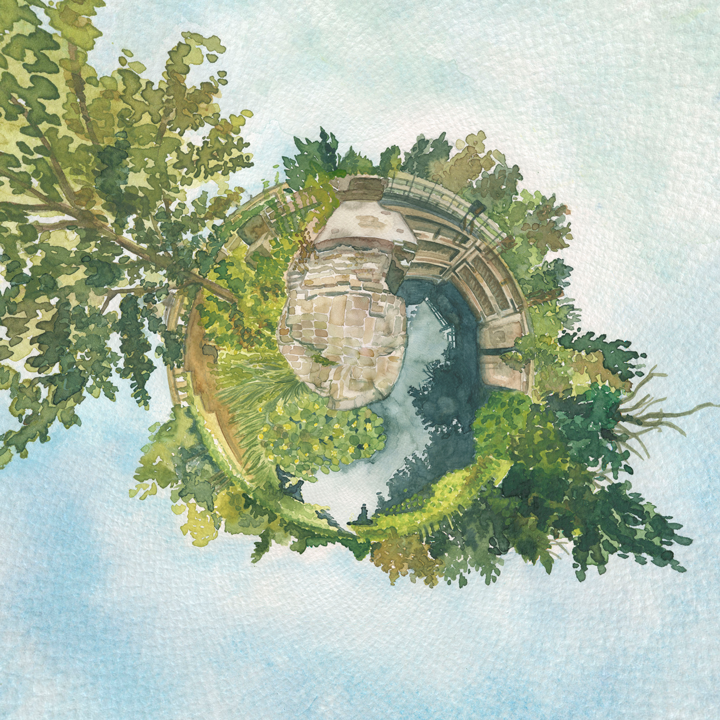
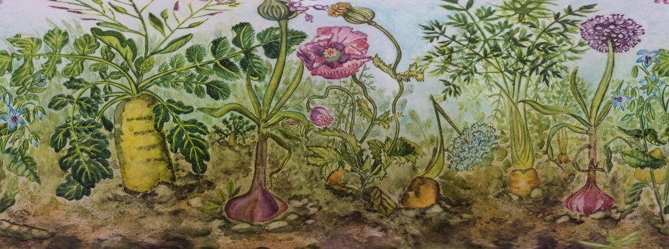
Drawing in little planet projection: Vijfsluizen in Watercolour
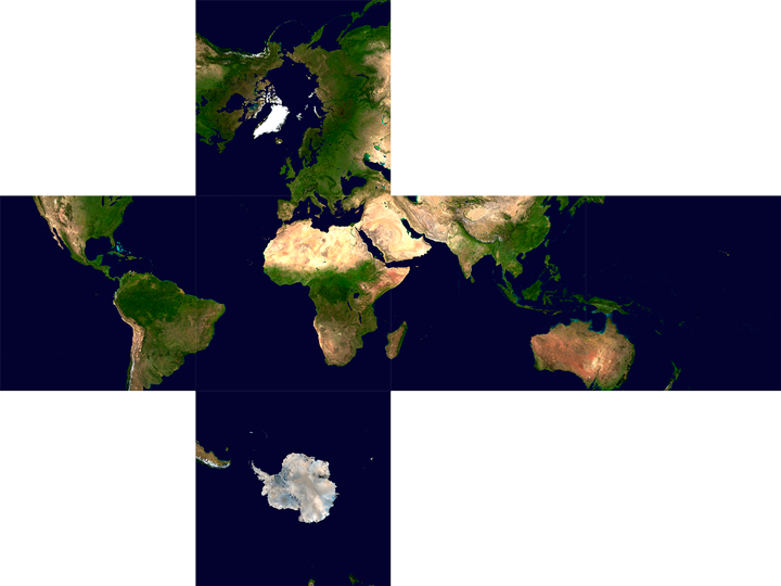
Map in cube face projection
Drawing in cube face projection: Vijfsluizen in Watercolour
